Guatemala Canicula 2026: How El Niño Turns a Mid-Summer Dry Spell Into a Food Crisis
Published: July 28, 2026 · 10 min read
TL;DR — Guatemala's 2026 Canicula: A Doubled Drought
The canicula — Guatemala's mid-summer dry spell — normally lasts 2-4 weeks. During El Niño years, it extends to 6-8 weeks. INSIVUMEH's 2026 seasonal forecast projects a canicula from early July through late August 2026, roughly double the normal duration. FEWS NET projects this will push 2-3 million Guatemalans in the Dry Corridor into acute food insecurity (IPC Phase 3) by October 2026. The WFP has pre-positioned 14,000 MT of food aid, enough for about 800,000 people for one month — but the affected population may be 2-3 times that large for 3-4 times that duration.
What Is the Canicula and Why Does It Define Guatemala's Harvest?
The canicula — from the Spanish canícula, derived from the Latin canicula meaning "little dog," a reference to Sirius, the Dog Star that appears in the summer sky — is a mid-summer dry period that occurs across southern Mexico and Central America. In Guatemala, it normally arrives in July and lasts 2-4 weeks. It's not a drought in the conventional sense — it's a predictable, expected pause in the rainy season, part of the natural bimodal rainfall pattern that defines the region's climate.
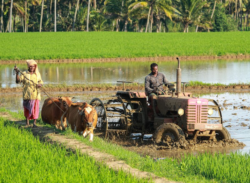
Guatemalan farmers have built their agricultural calendar around the canicula for centuries. The pattern works like this: the primera (first rainy season) begins in May, farmers plant maize and beans, and the canicula arrives in July. If the canicula stays within its normal 2-4 week window, the crops survive on residual soil moisture, and the segunda (second rainy season) arrives in August to carry them through to harvest in October-November. If the canicula extends beyond 4 weeks, the maize tassels and bean pods that formed in June-July dry up before the segunda can save them. The harvest fails. The household runs out of food by October-November. The hunger season — the period between when food reserves run out and the next harvest — extends from the normal 2-3 months to 6-8 months.
This is why canicula duration, more than total annual rainfall, is the single most important climate variable for food security in Guatemala's Dry Corridor. A year with 900mm of rain distributed across a normal bimodal pattern produces a good harvest. A year with 1,200mm of rain concentrated in May-June and October-November, with a 6-week dry gap in between, produces a failed harvest. The timing of the rain matters more than the total amount.
How El Niño Extends the Canicula
The Walker Circulation and Central America
To understand why the canicula lengthens during El Niño, you have to look at the Walker Circulation — the east-west loop of air that normally rises over the warm western Pacific (near Indonesia), flows east at high altitude, and descends over the cool eastern Pacific (near South America). During El Niño, the warm pool shifts eastward toward the central Pacific. The rising branch of the Walker Circulation follows it. The descending branch — warm, dry, cloud-suppressing air — shifts eastward too, parking over Central America.
For Guatemala, this means the afternoon thunderstorms that normally return in August to restart the segunda rains don't materialize. The descending air suppresses convection. The sky stays clear. Solar radiation beats down on already-drying soils. It's not that El Niño "causes" the canicula — the canicula is a natural feature of Central America's climate. But El Niño takes a 3-week dry spell and stretches it into a 7-week drought, right when maize and bean crops are at their most vulnerable.
SST Anomalies in the Eastern Pacific
There's a secondary mechanism at work too. El Niño warms not just the central equatorial Pacific but also the eastern Pacific off the coast of Central America. Warmer sea surface temperatures in the Gulf of Tehuantepec and the Pacific waters off Guatemala and El Salvador shift regional atmospheric circulation in ways that further suppress convection over land. This is a more localized effect — it operates on a 100-500km scale rather than the 10,000km scale of the Walker Circulation — but it reinforces the same outcome: less rain over the Dry Corridor during the critical July-September window.
The NOAA Coral Reef Watch data shows eastern Pacific SSTs already running +1.2°C to +1.8°C above normal off the Central American coast as of July 2026. This is consistent with the developing El Niño and supports INISVUMEH's projection of an extended, severe canicula.
The 2026 Canicula: What INSIVUMEH's Models Show
INSIVUMEH (Instituto Nacional de Sismología, Vulcanología, Meteorología e Hidrología) issued its 2026 seasonal forecast on June 30, and the numbers for the Dry Corridor are stark:
- Canicula onset: Early July 2026 (first week)
- Canicula duration: 6-8 weeks (normal: 2-4 weeks)
- Rainfall deficit during canicula: 40-60% below normal for July-August across the Dry Corridor
- Segunda rainfall onset: Late August to early September (normal: early August)
- Probability of extended canicula (6+ weeks): 72%
The 72% probability figure is the one to watch. It's derived from an ensemble of regional climate models that incorporate the NOAA CPC's ENSO forecast, eastern Pacific SST anomalies, and historical canicula patterns. A 72% probability of a severe canicula means the odds are roughly 3:1 in favor of crop-destroying drought in the Dry Corridor. For subsistence farmers, those aren't odds you can ignore — but they're also not odds you can easily act on when your only option is to plant or not plant.
The spatial distribution matters too. The canicula is consistently most severe in the eastern Dry Corridor departments — Chiquimula, Jalapa, Jutiapa, and eastern Santa Rosa — where the rain shadow from the Sierra Madre de Chiapas mountains is strongest. The western highlands (Huehuetenango, San Marcos) are somewhat buffered by orographic rainfall, but even there, INSIVUMEH projects a 3-5 week canicula duration (up from 1-2 weeks normally), which is enough to stress maize during grain-fill.
Lessons from Past Canicula Crises
Guatemala has lived through this before, and the record is instructive about what 2026 could bring.
The 2015 Canicula: The Benchmark
The 2015 canicula, during the last very strong El Niño, lasted 6-7 weeks across the Dry Corridor. It's the closest historical analog to what INSIVUMEH is forecasting for 2026. The damage was catastrophic:
- Maize production dropped 60-80% in the Dry Corridor departments (Chiquimula, Jalapa, Jutiapa, Santa Rosa)
- Bean production fell 50-70% in the same areas
- The government declared a state of emergency in August 2015, covering 16 departments
- WFP estimated 2.3 million Guatemalans faced acute food insecurity
- Acute malnutrition rates in children under 5 in the Dry Corridor rose from a baseline of 4.2% to 7.8% — nearly double
- Recovery took 2-3 years: many households that sold livestock and took on debt in 2015 had not fully rebuilt by the time the 2023-24 El Niño arrived
The 2023 Canicula: Compounding Vulnerability
The 2023 canicula was shorter (5-6 weeks) but occurred against a backdrop of already-depleted household assets from the 2015-16 event and the economic aftershocks of the pandemic. Maize losses were 40-50% in the Dry Corridor. An estimated 1.5 million Guatemalans required food assistance. The key lesson: the impact of a canicula isn't just about its duration — it's about the vulnerability of the population when it arrives. Guatemala enters the 2026 canicula in a weakened state, which means a canicula of similar duration to 2015 could produce more severe outcomes.
Food Security: The Numbers Behind the Forecast
FEWS NET's July 2026 Food Security Outlook for Guatemala projects a deteriorating situation in the Dry Corridor through the remainder of the year:
- Current classification (July 2026): Parts of the Dry Corridor are classified as IPC Phase 2 (Stressed), meaning households are meeting minimum food needs but only by depleting essential livelihood assets
- Projected classification (October 2026): These areas escalate to IPC Phase 3 (Crisis), with acute food insecurity affecting 2-3 million people — 15-20% of Guatemala's population
- Key drivers: Extended canicula destroying primera harvests, depleted household grain reserves, above-normal staple food prices, reduced casual labor opportunities
- Most at risk: Subsistence farming households in Chiquimula, Jalapa, Jutiapa, Santa Rosa, Zacapa, El Progreso, and parts of Baja Verapaz and Huehuetenango
The food price dynamic deserves special attention. Guatemala imports roughly 45% of its maize — primarily from the United States. If the 2026-27 El Niño simultaneously damages maize production in the US Midwest (which El Niño summers tend to do, through cooler-wetter conditions that delay planting) and Guatemala's own production, maize prices could spike 20-40% above normal. For households spending 50-60% of income on food, a 30% increase in maize prices is equivalent to a 15-18% loss of real income. For comparison, see our analysis of how El Niño drives global food prices.
What Is Being Done to Prepare
The international response system has more advance warning for the 2026 canicula than for any previous El Niño event, thanks to the lead time provided by NOAA's ENSO forecast. But warning doesn't equal preparation, and preparation doesn't equal sufficient response.
The WFP pre-positioned 14,000 metric tons of food aid in Guatemala in June 2026. That's enough to support roughly 800,000 people for one month at emergency ration levels — but if the affected population is 2-3 million people for 3-4 months, the math doesn't add up. The gap between prepositioned supplies and potential need is in the range of 80,000-120,000 MT.
Guatemala's Ministerio de Agricultura, Ganadería y Alimentación (MAGA) distributed drought-tolerant maize seed to 50,000 farming households in the Dry Corridor before the planting season. The varieties — primarily ICTASA and HB-83 — can produce a partial harvest with 40-50% less rainfall than normal maize. That's meaningful for water stress, but less effective against a 6+ week dry spell during the critical reproductive stage. Even drought-tolerant maize needs some moisture during tasseling and grain-fill.
FAO is supporting community grain banks in 12 Dry Corridor municipalities — communal storage facilities where farmers can deposit and withdraw grain at stable prices, insulating them from the price spikes that normally accompany a failed harvest. These are proven effective at the community scale, but they reach perhaps 50,000-80,000 households in a region with over 400,000 subsistence farming families.
The reality: the preparation is better than in 2015, but the potential scale of the 2026 canicula crisis exceeds what prepositioned aid and community-level interventions can handle alone.
What to Watch in July-August 2026
For anyone tracking Guatemala's 2026 canicula — whether for humanitarian planning, agricultural investment, or understanding how El Niño unfolds on the ground — here are the indicators that matter:
- Weekly rainfall data from INSIVUMEH: Monitor the cumulative rainfall for July 1-August 15 in Chiquimula, Jalapa, and Jutiapa stations. If totals stay below 40% of normal, a failed primera harvest is essentially guaranteed.
- Maize and bean wholesale prices in Guatemala City's La Terminal market: Prices normally peak in July-August (the lean season) and decline as the nueva cosecha (new harvest) arrives in September-October. If prices don't decline by mid-September, it means the harvest has failed.
- FEWS NET monthly updates: The August and September reports will classify the actual food security situation, incorporating canicula duration data from the ground.
- Onset of segunda rains: If the second rainy season begins before August 15, partial recovery of the harvest is still possible. If it starts after September 1, the window for a meaningful segunda is essentially closed.
- Government emergency declarations: Historically, Guatemala's government declares a state of emergency when the canicula reaches 5+ weeks in the Dry Corridor. A declaration in August 2026 would confirm severe conditions.
The 2026 canicula is forecast. The drought-tolerant seeds are distributed. The food aid is pre-positioned. What remains is the canicula itself — and whether Guatemala's Dry Corridor communities can survive a drought that may be twice as long as they've planned for.
For the broader regional context, see our guides on El Niño in Central America, How El Niño Affects Nicaragua, and El Niño and Global Drought.
Explore more at the El Niño Guide — comprehensive climate science explained.